
We looked at 138 formerly redlined cities and found most were still segregated — just like they were designed to be.
In 1939, officials working with the Home Owners’ Loan Corporation (HOLC) went to Cleveland, Ohio, as part of the agency’s national effort to grade neighborhoods based on their perceived mortgage-lending risk.
One of the neighborhoods that officials visited — now known mostly as Fairfax — was 55 percent Black, and as such, they gave this area a “D” grade, meaning they thought Fairfax was “hazardous,” or at high risk for defaulting on mortgage loans. In their report, HOLC officials concluded that property prices were trending down due to a “strong colored infiltration” and that there was a “detrimental change of ownership occupancy from white to colored.” Fairfax, like most metropolitan neighborhoods where Black people lived in the early 1900s, was then marked with red ink in the HOLC’s maps — a practice referred to as redlining.
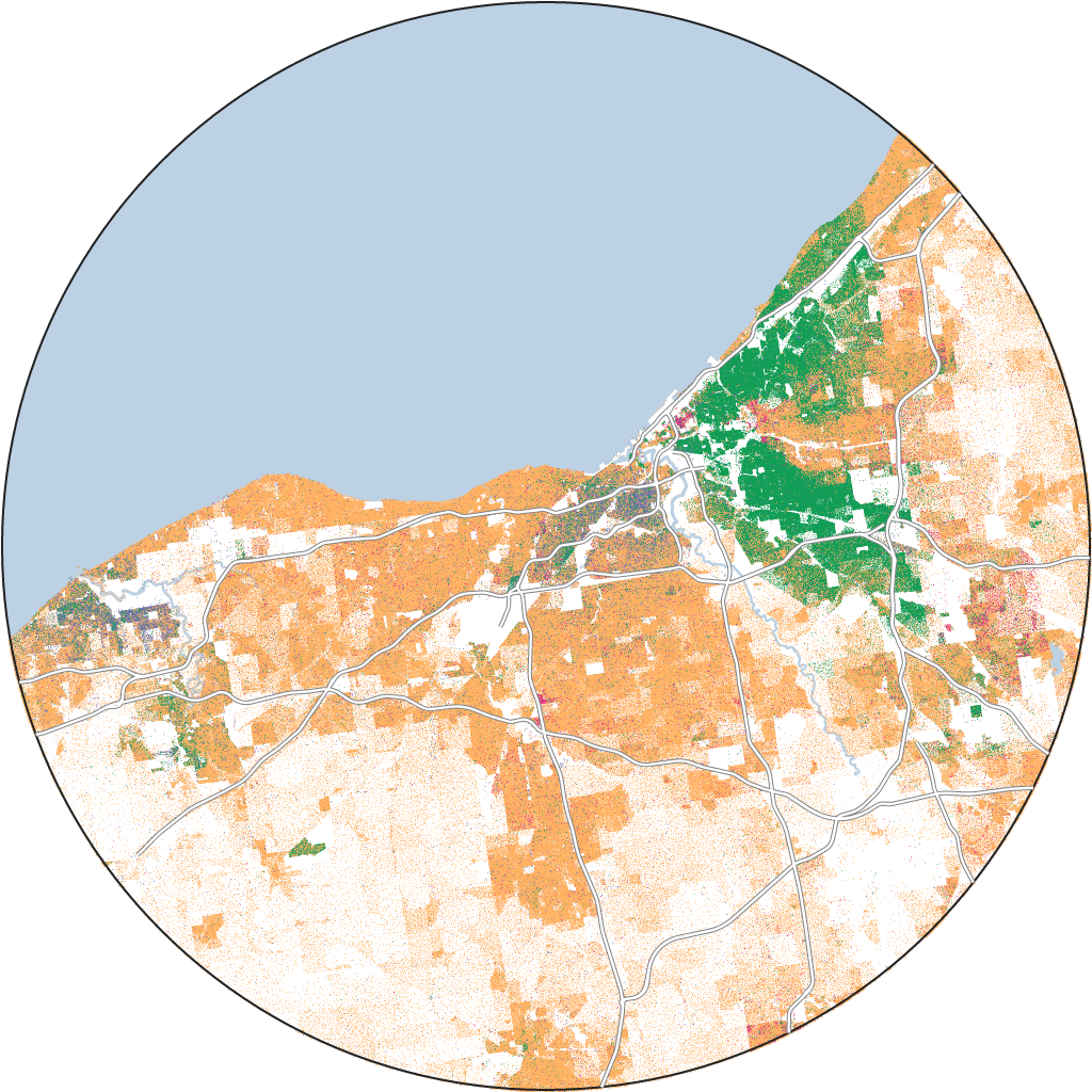
It’s been over 80 years since the lines were drawn in Fairfax and over 50 years since the use of redlining was legally banned, but the impact of redlining is still felt in cities like Cleveland, where redlined neighborhoods are some of the most starkly segregated in the country.
But it’s not just Cleveland. In its 20 years of existence, the now-defunct HOLC drew hundreds of these maps across the country. In total, we analyzed the demographics of 138 metropolitan areas where HOLC drew maps, using data provided by the University of Richmond’s Mapping Inequality project and by the 2020 census. And we found that nearly all formerly redlined zones in the country are still disproportionately Black, Latino or Asian compared with their surrounding metropolitan area, while two-thirds of greenlined zones — neighborhoods that HOLC deemed “best” for mortgage lending — are still overwhelmingly white.
“The redlining maps are like the Rosetta stone of American cities,” said LaDale Winling, a professor of history at Virginia Tech and one of the researchers behind the Mapping Inequality project. Winling told us that these maps were used to codify and institutionalize practices that had already been ongoing at a more scattershot level within the real estate industry.
You can see the effects of that institutionalized segregation clearly in this national map of formerly greenlined and redlined zones:
Most formerly redlined zones are people of color; most greenlined zones are white
Estimated 2020 share of non-Hispanic white residents living within greenlined (“best”) and redlined (“hazardous”) boundaries drawn by the Home Owners’ Loan Corporation between 1935-40, by metropolitan area
But despite formerly redlined zones sharing a purpose — to disproportionately deny loans to low-income Americans and, in particular, Black and minority Americans — the legacy of redlining differs from city to city and region to region.
Formerly redlined zones in the Northeast and Midwest are among the most segregated areas in the country. In those regions, a higher proportion of Black Americans live in redlined zones compared with those zones’ surrounding areas — and a higher proportion than can be found in other regions of the country. Meanwhile, in the South, formerly redlined zones aren’t as segregated. But less residential segregation doesn’t mean that the South is a more equitable region for Black and minority Americans, especially given its history of slavery and the Jim Crow era. Additionally, even though redlining was a housing policy that heavily targeted Black Americans, redlining has also affected immigrants and other minorities, in particular Latino Americans — something visible today in places like California. But at the same time, huge demographic shifts, suburbanization, urban renewal and gentrification have also changed the landscape of many of these cities. In some cities, formerly redlined zones are now whiter and more developed than they were in the 1940s. In other cities, there are more Black people than white people living in formerly greenlined areas, or areas that government officials once rated as “best.”
There is no one legacy when it comes to redlining. And its legacy is particularly devastating because, as we were told by Stephen Menendian, assistant director of the Othering & Belonging Institute at the University of California, Berkeley, "Housing really is at the core of every expression of racial inequality in America."
The myth of the northern “Promised Land”
The legacy of redlining is particularly pronounced in the Northeast and Midwest, where cities like Cleveland, Pittsburgh and Chicago are home to some of the most segregated formerly redlined zones in the country. This segregation is especially entrenched in redlined cities with large Black populations. Of the 19 such cities in these regions, 16 were still segregated, with over two-thirds as many Black people living in formerly redlined areas as in the surrounding area. White people, meanwhile, made up less than a third of the population of formerly redlined areas and were vastly overrepresented in formerly greenlined areas.
One reason northern cities remain so segregated is because of what historians call the Great Migration and Second Great Migration. From the 1910s through the 1970s, millions of Black Americans fled the oppressive Jim Crow South in search of jobs in industrialized cities and a better life in the Northeast and Midwest. But Black Americans didn’t find refuge from systemic racism in these regions, especially when it came to housing policy.
In fact, scholars have found that the increase in Black Americans in these regions led to growing efforts like redlining in northern metro areas to keep Black Americans and other immigrants in specific areas and prevent them from moving into predominantly white neighborhoods. Consequently, Black families had little opportunity to build generational wealth.
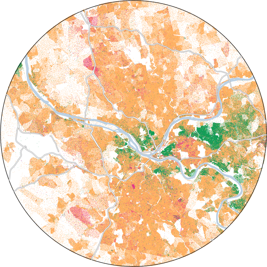
Take Pittsburgh. It saw a massive uptick in its population in the early 1900s, but Black Americans moving in were limited to pre-war segregated areas like the Hill District, which in 1937 was officially redlined by HOLC officials because of what they described as an “infiltration” and “concentration of negro and undesirables.”
Today, the Hill District, like all neighborhoods encompassing formerly redlined zones in the Steel City, is still overwhelmingly segregated. Pittsburgh’s formerly redlined zones have, on average, close to three times as many Black people living in them as compared to their surrounding areas — making Pittsburgh the second most segregated redlined city in the country, just behind Cleveland.
Pittsburgh, PA
Pittsburgh'szones:
Pittsburgh's surrounding area:
One reason why an area like the Hill District is still so segregated is that redlining created a lack of investment in parts of Pittsburgh that persists today. Last year, a team of researchers released a report that looked at bank lending data and public investment documents in Pittsburgh from 2007 to 2019, finding that just 7 percent of home mortgage loans went to predominantly minority neighborhoods in that time period, despite the residents of these neighborhoods comprising almost 21 percent of the city’s population. And out of $11.8 billion in loans to borrowers, less than 4 percent went to Black people.
“[Redlining] biased where investment was made,” Bruce Mitchell, a senior analyst at the National Community Reinvestment Coalition told us, with “hazardous” areas like Hill District suffering from years of neglect. Mitchell said it's this lack of investment in formerly redlined areas that is one of redlining’s most devastating consequences.
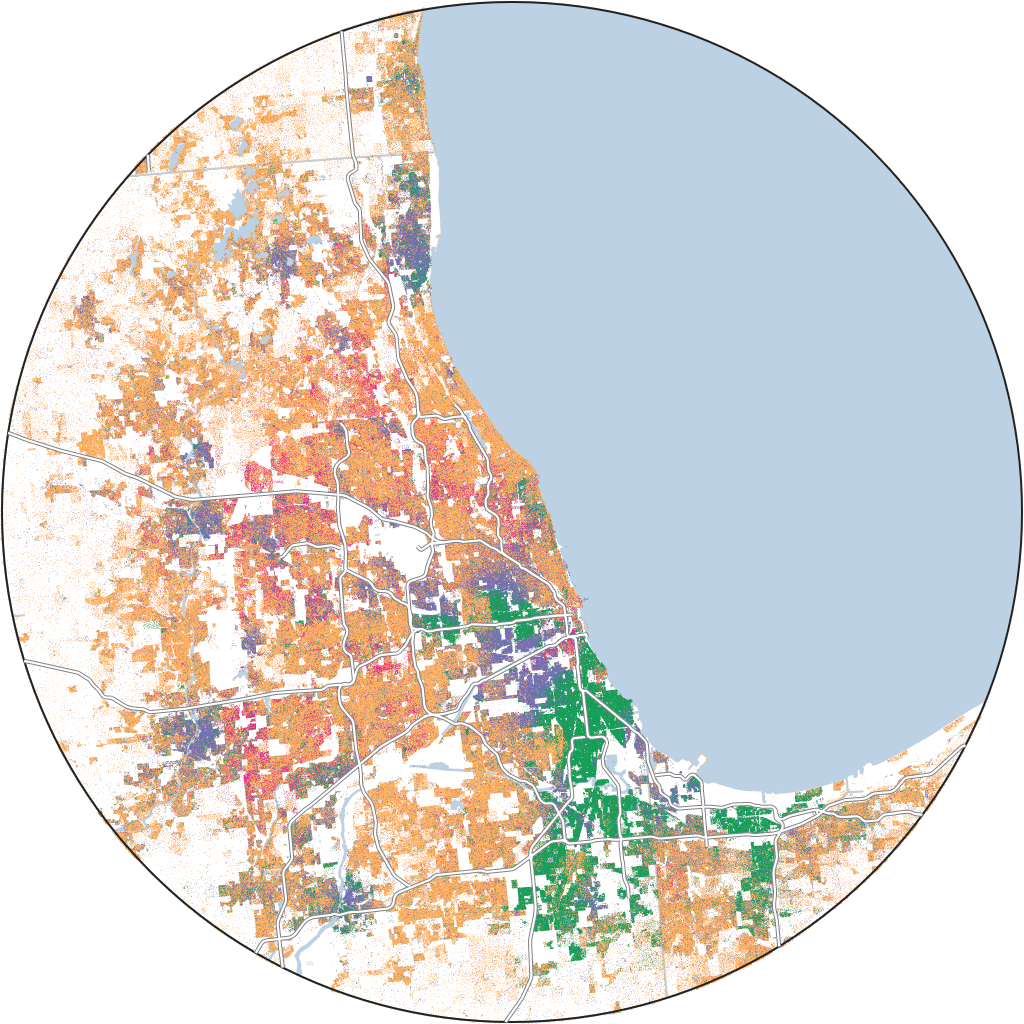
Like Pittsburgh, Chicago saw a huge surge in its Black population as part of the Great Migration. Many Black people moved to Chicago’s South Side, north of Washington Park — the area where many of Chicago’s redlines were ultimately drawn.
At the time government appraisers drew those lines, housing near parks, lakes and swimming pools was typically inhabited by white people, but in one zone surrounding Washington Park appraisers noted that it had been “almost completely monopolized by the colored race.” Appraisers concluded that Black Americans couldn’t be “closed in” and Washington Park was already “doomed,” so they drew a redline around the area in their map.
Today, there are over 90 percent more Black Chicagoans in redlined zones than in the surrounding area.
Chicago, IL
Chicago'szones:
Chicago's surrounding area:
How an anti-Black past in the South shapes its present
In the South, most formerly redlined areas are also still starkly segregated — 28 of the 31 cities we analyzed. And while they aren’t as segregated as formerly redlined zones in the North, the formerly greenlined zones in the South are more segregated than in the North. On average, the South has almost twice as many white people living in greenlined zones compared with those zones’ surrounding areas — a much higher share than is seen in the North.
That’s important for understanding the legacy of redlining in the South because slavery and Jim Crow laws have played a much bigger role in the South’s unique form of segregation. Winling, who was one of the researchers behind the Mapping Inequality project, told us that Black Americans in the North began to move into greenlined areas after white populations started to flee because city neighborhoods were rapidly diversifying. But in some southern cities, he said, this didn’t happen to the same extent.
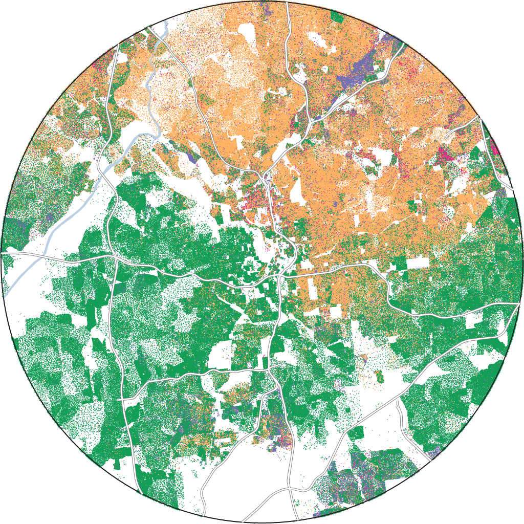
Take a city like Atlanta. Its neighborhood of Buckhead held the headquarters of the Ku Klux Klan from the early 1920s to the mid-1930s. Currently, Buckhead is the city’s whitest and wealthiest neighborhood, and it’s also where most of the “best” areas were drawn during in the late 1930s. And as can be seen on the map below, those “best” areas are 80 percent white.
Atlanta, GA
Atlanta'szones:
Atlanta's surrounding area:
Buckhead also remains very segregated from the rest of Atlanta. In fact, neighborhood residents are now backing an effort in the city’s legislature to create their own city and secede from Atlanta, a majority Black city. If this were to happen, it would be financially devastating for Atlanta since the city would lose an estimated 38 percent of its tax revenue.
According to Andre Perry, a senior fellow at Brookings Metro and author of “Know Your Price: Valuing Black Lives and Property in America’s Black Cities,” it is these white enclaves in the South “where power is often exercised the most.”
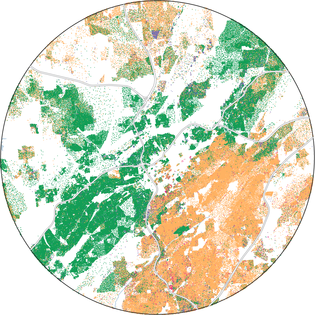
Part of the way these areas amassed power was through the South’s long history of violent racism toward Black Americans, especially those moving to predominantly white neighborhoods. Consider Birmingham, Alabama, a city where bombings against Black residents were so rampant in the mid-1900s — there were more than 50 house bombings and burnings from the late 1940s until the mid-1960s — that Birmingham became known as “Bombingham.”
This ongoing violence, in addition to redlining, meant that much of Birmingham’s white population was confined to its greenlined zones. This pattern is still visible today, with the share of white people living in the city’s formerly greenlined zones being over twice as high as the share living in the surrounding area. In fact, per an ABC News analysis of mortgage-lending data, people of color are still less likely to have their loans approved in majority-white neighborhoods.
Birmingham, AL
Birmingham'szones:
Birmingham's surrounding area:
But parts of the South’s racial makeup are changing, albeit slowly. Since the 1990s, more and more Black Americans have moved to the South — a movement demographers are terming “The New Great Migration.” This has changed cities like Atlanta and Birmingham, which have also seen an influx of Asian Americans and other minorities, but according to Taylor, the Princeton professor, the South’s fixation on white exclusivity in places like Buckhead is still a big problem.
“People are returning to places that are just as segregated, just as excluded,” Taylor said.
“Anti-Black racism hurt everyone”
The harm redlining has caused Black Americans is extensive, but redlining has also affected other minorities in the U.S. — particularly the country’s growing Latino population. In some cities, government officials directly targeted Latinos with their redlining maps while in others, the continued lack of investment in formerly redlined areas has caused disproportionate harm to Latino communities.
Of 50 cities across the country with large Latino populations, we found that 72 percent have segregated Latino communities living in formerly redlined areas.
“That’s why I always say, anti-Black racism hurt everyone,” Perry said. “There's lots of places where … anti-Black racism and hate against brown people and other groups really limited the amount of housing options for people of color, and the only places that they can generally go are formerly redlined or Black neighborhoods.”
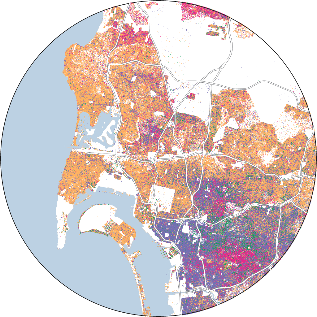
Take San Diego. Its formerly redlined zones are the most segregated in the West, with 76 percent more Latinos living in these neighborhoods compared to the surrounding areas. Latinos were targeted by HOLC appraisers, too, as they wrote in their 1935 report that the area southeast of Fairmont Park had “many Mexicans with a definite trend of infiltration.”
San Diego, CA
San Diego'szones:
San Diego's surrounding area:
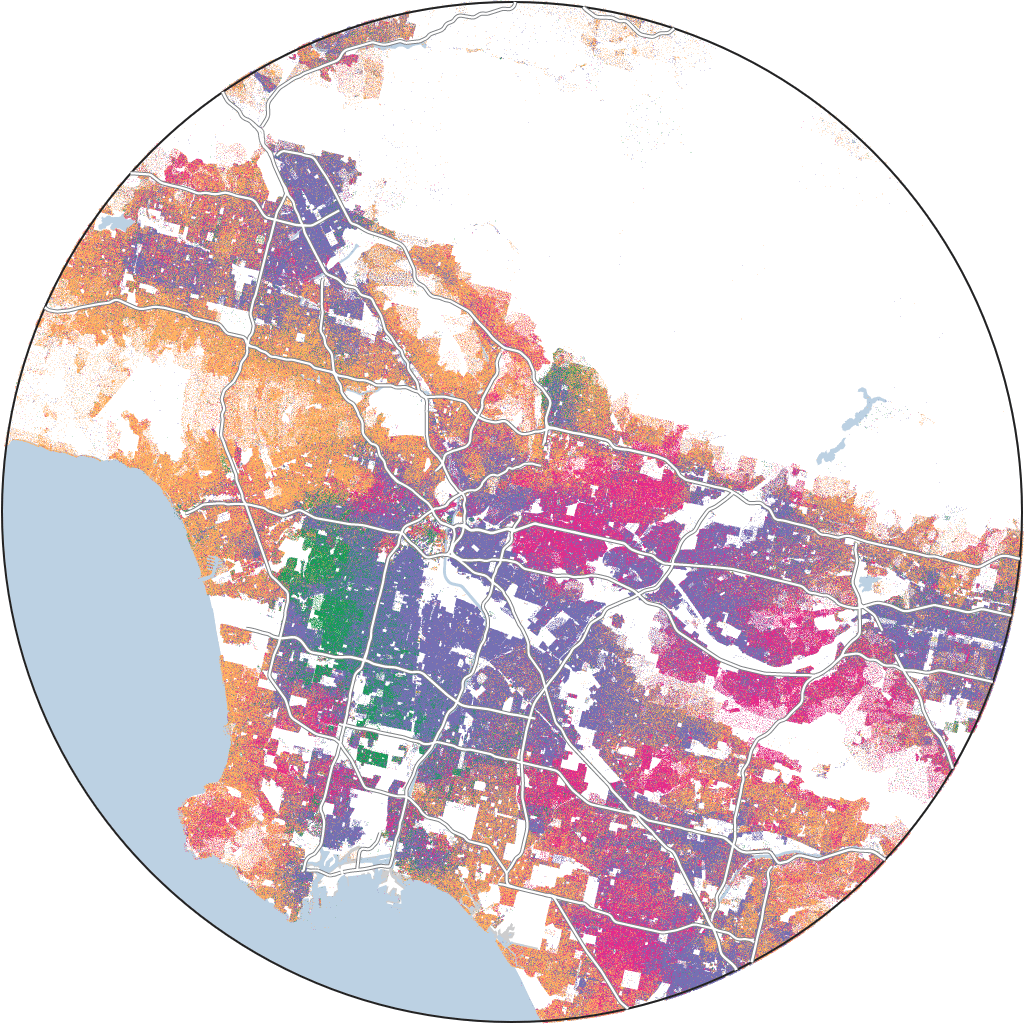
In other parts of California, appraisers used even harsher, more racist language. In 1939, San Gabriel, a city in Los Angeles County, was 90 percent Mexican American, and appraisers described them as “peon Mexicans” and as a “distinctly subversive racial influence.”
Up until 1930, the U.S. census classified Mexicans as white, but in the 1930 census, the government classified them as their own race. According to Jerry González, a historian at the University of Texas at San Antonio, this allowed the U.S. government to more easily target Mexican Americans as a racial threat.
This targeting was especially clear in redlining practices of the time. González told us that officials would specifically identify Mexicans living in places like Los Angeles, and then include language in their reports like, “do not sell this home to persons not fully of the Caucasian race.” González said that language gave housing officials the flexibility to more easily discriminate.
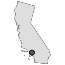
Los Angeles, CA
Los Angeles'szones:
Los Angeles's surrounding area:
It’s not just Latinos that HOLC officials targeted either. Appraisers described other areas derisively as a “melting pot … long been thoroughly blighted,” also classifying Asian Americans as “subversive racial elements” in California. Today, San Gabriel’s Asian and Latino communities are still segregated from the city’s white population.
Beyond the red lines
Of course, segregation in many cities doesn’t fit neatly inside formerly redlined zones. This doesn’t mean, however, that these cities avoided or overcame a racist housing system. On the contrary, housing segregation manifests in ways that go far beyond HOLC’s color lines on these maps.
"The refusal of federal agencies to issue mortgages to those neighborhoods in the 1930s and 40s — that's one of many policies that were followed," Richard Rothstein, author of “The Color of Law,” said. "But it doesn't entirely determine today's landscape, and there are many, many other policies that get ignored that are equally important."
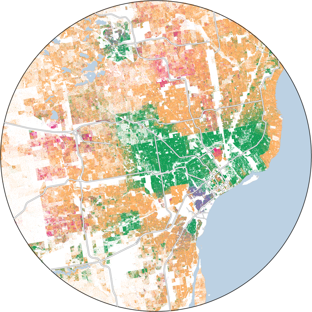
For instance, even though it is one of the most segregated cities in the country, Detroit’s segregation doesn’t match up with its formerly redlined zones. This is in large part because as Black southerners moved into Detroit during the Great Migration, white Detroiters responded by leaving the city in droves, mostly moving out to federally subsidized and racially homogenous suburbs — a migration that historians call “white flight.” White Detroiters went through great lengths to keep their wealthy suburbs exclusively white, too, with measures as extreme as building a half-mile-long concrete wall to physically separate themselves from Black families.
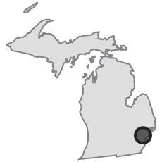
Detroit, MI
Detroit'szones:
Detroit's surrounding area:
According to Joe Darden, a professor of geography, environment and spatial sciences at Michigan State University, the Detroit metro area continues to experience white flight, too. As Black Detroiters move into predominantly white suburbs, many white Detroiters move away — further perpetuating residential segregation.
“The future of Black suburbanization is going to be looking at those places that used to be predominantly white, and turning them more and more to be predominantly Black,” Darden said. “As Blacks move in, whites, even to this day, still have a tendency to move further and further out.”
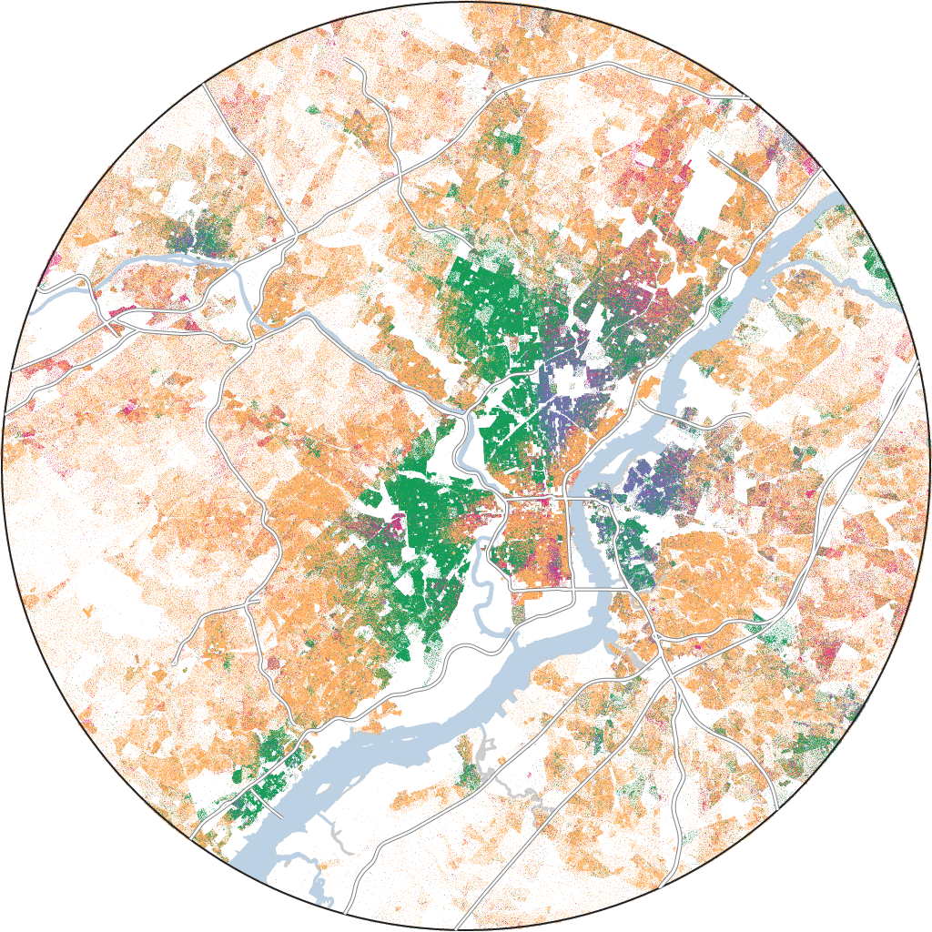
Meanwhile, Philadelphia is seeing the opposite happen: More white people are moving into its formerly redlined zones. And as this occurs, property values increase and lower-income people, many of whom are Black, can no longer afford to stay.
This gentrification has fundamentally shifted where Philadelphia’s varying demographics reside so that its present-day segregation doesn’t really match up against its formerly redlined zones. In 2019, a study by the National Community Reinvestment Coalition found that seven cities account for almost half of all the gentrification in the U.S., and by their metrics, Philadelphia was one of the cities where gentrification was most rampant.
Philadelphia, PA
Philadelphia'szones:
Philadelphia's surrounding area:
In recent years, it’s become popular among some Democrats to tout proposals that will remedy segregation caused by redlining. But Taylor told us that these measures often fail to account for how the maps have changed over time. For instance, in Philadelphia, young white people have been able to move into historically Black neighborhoods and buy homes by using programs associated with the Community Reinvestment Act of 1977, which was intended to remedy the damage of redlining. In fact, per an ABC News analysis, it’s now easier for white people than people of color to buy homes in historically nonwhite neighborhoods. In 2019, 65 percent of the 347,000 white homebuyers who applied for mortgages in mostly nonwhite neighborhoods in the country’s largest metro areas were approved, compared with 56 percent of 715,000 nonwhite homebuyers who received a loan in those same neighborhoods.
What’s more, Taylor said, simply encouraging homeownership in neighborhoods like East Germantown, where the housing stock is old and dilapidated, could saddle Black Americans with debt. Without being able to fund repairs or escape long, predatory mortgages, these programs could exacerbate the housing crisis and push more Black people out of their neighborhoods.
“There’s no money to be made in affordable housing, and so all the building that is happening now are million-dollar condos, because that’s where the money is,” Taylor said.
Some 40 years after the first redlining map was drawn, redlining was banned under the Fair Housing Act of 1968. But in many ways, HOLC and the Federal Housing Administration had already written the textbook for racist real estate practices.
“[The Fair Housing Act of 1968] doesn’t roll back or undo or make amends for 50 years of housing discrimination that had gone on up to that point,” said Winling, the Virginia Tech historian involved in the Mapping Inequality project. “It’s going to take probably another 80 or 90 years of vigorous enforcement and vigorous remediation to undo that legacy.”
The legacy of redlining extends far beyond housing segregation, too. Its impact can be seen today in minority neighborhoods’ access to health care, poorer educational opportunties, and increased risk of climate change, as many of these areas are more prone to flooding and extreme heat. Without a serious confrontation of its lasting generational damage, the racial segregation caused by redlining isn’t going anywhere either.
“I look at it as: Redlining happened. It was an important part of American history,” Perry said. “And we must reckon with the behaviors and the outcomes in ways that never discount what redlining did. And again, it has different stories for different cities, but redlining is a part of that story. It just is.”
Cleveland'szones:
Cleveland's surrounding area:
About this analysis
Redlining maps used in this project were originally drawn by the now-defunct Home Owners’ Loan Corporation (HOLC) from 1935-40 and downloaded from the Mapping Inequality project. Individual HOLC zones that fall within the same metropolitan area were grouped according to census micro- or metropolitan area definitions. A small number of HOLC zones fractionally overlapped in source map shapefiles; these overlaps were carved out of the geographically larger zone.
Population and race/ethnicity data comes from the 2020 U.S. decennial census. Population counts were aggregated from census blocks, which are the smallest geographic census units and offer the most precision when matching census data to other geographic shapes. HOLC zones were matched to census data by first determining which census blocks geographically intersected with each zone. Data from all matching blocks was then weighted by the proportion of the block’s total area that intersects with that HOLC zone and summed to estimate the 2020 demographic makeup of each HOLC zone.
The surrounding area for each metropolitan area’s HOLC map was computed by adding a 10 percent buffer radius to the combined zones in that metropolitan area. Surrounding area population totals were then computed by summing census-block population data, weighted by the proportion of each block’s total area contained within the surrounding area’s border.
For each metropolitan area’s HOLC map, a location quotient (LQ) — a small-area measure of segregation that specifically compares one racial/ethnic group’s proportion in a granular geography to its proportion in a larger surrounding geography — was calculated for combined A-, B-, C- and D-rated zones for each racial/ethnic group. An LQ above 1 for a given racial group indicates overrepresentation in that HOLC zone compared with the broader surrounding area, and values below 1 indicate underrepresentation. A metropolitan area’s HOLC zones were defined as segregated for a minority racial/ethnic group if: (1) its LQ in D-rated zones was greater than 1 (suggesting this group was overrepresented in redlined areas); (2) its LQ in D-rated zones was greater than its LQ in A-rated zones (suggesting this group was more represented in redlined areas than in greenlined areas); and (3) its LQ in A-rated zones was smaller than the white population’s LQ in A-rated zones (suggesting this group was not more represented in greenlined areas than the white population).
Population density dots were generated for each racial/ethnic group within a census block, with each dot representing one person. Dots were placed randomly within a census block and do not represent exact locations but rather the total population of a given race/ethnicity in that block. White, Black and Asian data excludes those who indicated Hispanic or Latino ethnicity. Hispanic/Latino data includes all who indicated Hispanic or Latino ethnicity, regardless of race. Other race data includes all population counts that did not fall under white, Black, Asian or Latino. The Albers Equal-Area Conic projection, which guarantees areas on one map are equivalent to areas on another map, was used for all maps and spatial calculations.
"lasting" - Google News
February 09, 2022 at 06:00PM
https://ift.tt/8sNQ53m
The Lasting Legacy Of Redlining | FiveThirtyEight - FiveThirtyEight
"lasting" - Google News
https://ift.tt/D7URVu2
Shoes Man Tutorial
Pos News Update
Meme Update
Korean Entertainment News
Japan News Update
Bagikan Berita Ini







0 Response to "The Lasting Legacy Of Redlining | FiveThirtyEight - FiveThirtyEight"
Post a Comment